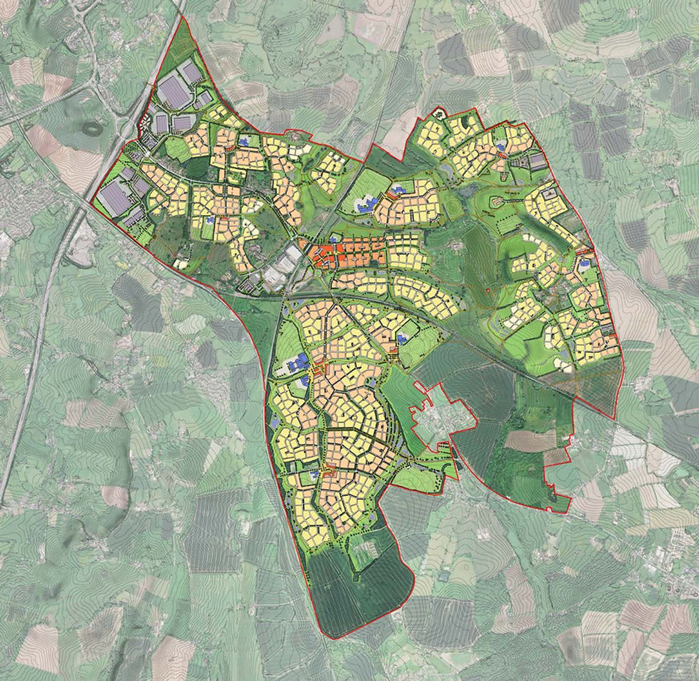
THE SITE
The site forms the southern part of the Abbotswood Ridge Neighbourhood and extends to approximately 85 hectares south of Abbotswood Road (OS Reference 8952 4900).
The site comprises agricultural land and is bounded by the existing railway line to the west, Wadborough Road to the east and agricultural land to the south.
The settlement of Stoulton is located to the north east of the site, whilst the village of Hawbridge is situated to the east.
The land under the control of Wain Estates includes an additional area of circa 21 ha, which forms part of the Stoulton Buffer, which is included within the Wychavon Town Supplementary Planning Document to assist in preserving the setting of Stoulton village.

Site Location
Click on the above image to view a larger version
.jpeg)
Illustrative Masterplan
Extract from the Wychavon Town Spatial Framework SPD